2012-present: Gordon and Betty Moore Foundation – Patagonia and West GreenlandThis project, generously funded by the Gordon and Betty Moore Foundation, will deploy state-of-the-art airborne gravity, airborne ground-penetrating radar and laser profiling technologies mounted on helicopters to provide, for the first time, high resolution, high precision mapping of glacier thickness and coastal sea floor depth in and near the Patagonian Ice Fields of Chile and in the glacial fjords of West Greenland. Partners in the three-year project will be Centro de Estudios Cientificos in Chile and Sander Geophysics in Canada. The news release on the award can be found here. |
|
2011-present: NASA Cryosphere Proposal to map ice thickness using IceBridge data combined with InSAR dataUnder construction… |
|
2011-present: ECCO3 Ocean Modeling in collaboration with JPLUnder construction … Full Title: Estimating the Circulation and Climate of the Ocean, Phase III (ECCO3): Improved Representation of Ocean-Ice Interactions in Earth System Models |
|
2011-2013: NSF EAger proposal on the Ice Sheet System ModelISSM is the result of a collaboration between the Jet Propulsion Laboratory and University of California at Irvine. Its purpose is to tackle the challenge of modeling the evolution of the polar ice caps in Greenland and Antarctica. ISSM is funded by the NASA Cryosphere and MAP (Modeling Analysis and Prediction) programs, JPL R&TD (Research, Technology and Developmnt) and NSF. For more details, go to http://issm.jpl.nasa.gov/ NEWS: December 2011: ISSM open-source release. |
|
|
|
2008-present: A three-dimensional, high-resolution flow model of the Greenland ice sheet: validation and predictionSee ISSM web site. |
|
2007-2009: Warm Ice Sounding Explorer (WISE)JPL in collaboration with the University of Iowa and UCI owns and operates an airborne GPR, the Warm Ice Sounding Explorer (2 MHz). |
|
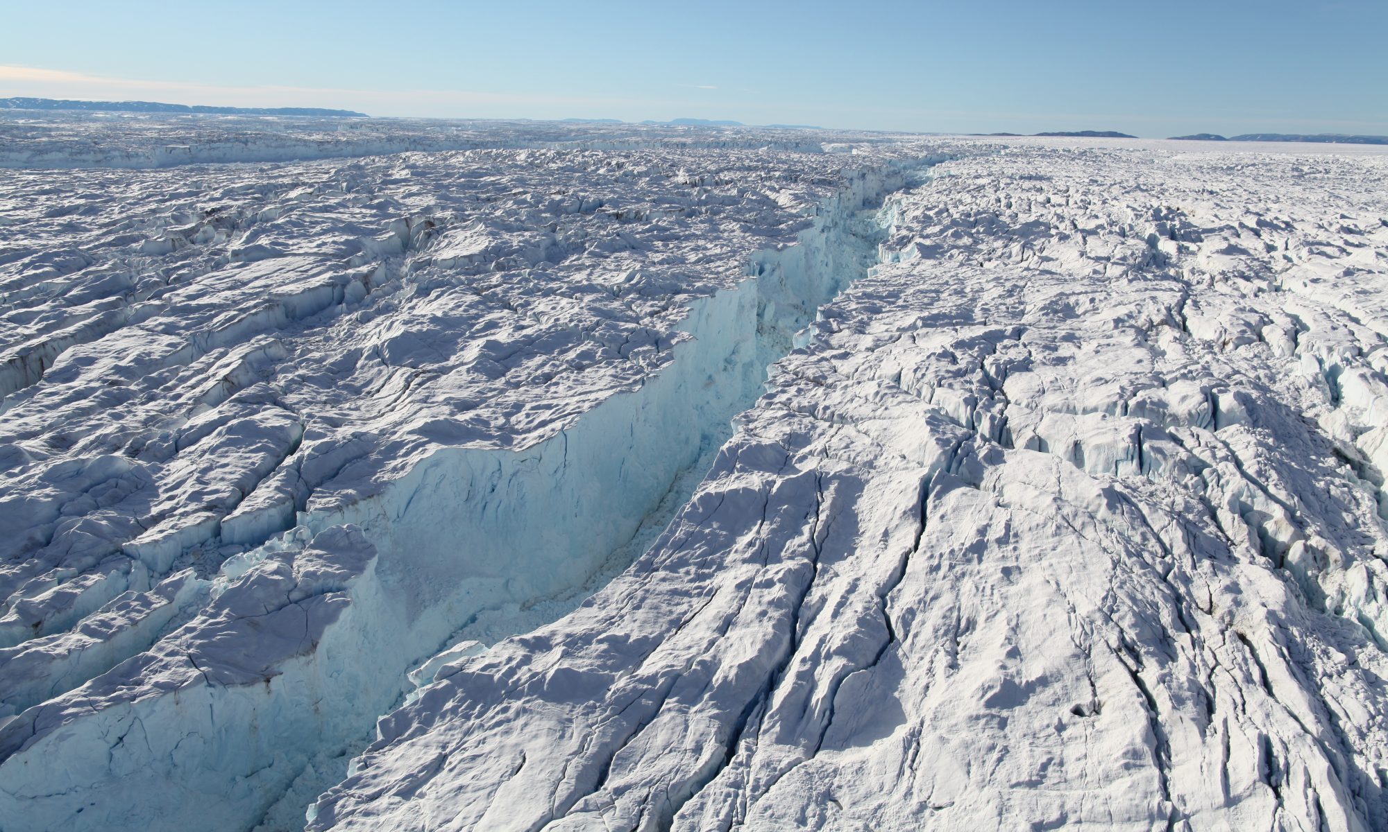
2008-present: Subaqueous melting of Greenland GlaciersIn this project the mechanism of subaqueous melting of glacier faces by the ocean are investigated using field surveys (multi-beam echo sounding, CTD, GPRI), remote sensing (InSAR, Landsat), and modeling (ISSM, MITgcm). Each year, we embark on a field expedition in Greenland to investigate a new area, map entire fjords system, including the submerged face of calving glaciers. |
|
2007-present: Stability of Larsen C Ice Shelf in a Warming ClimateThis project started under the hospice of IPY is ongoing to unravel the secret of why ice shelves start to break up. No, hydrofracture is not the answer; no storms and tsunamis are not the answer. |
|
2010-2020: IceBridge Science Team – A Glacier dynamics and ice-ocean interactions perspective for IceBridge scienceRignot serves as the Science Team Lead for NASA Operation IceBridge which is currently undergoing its last campaign in East Antarctica and probably the most ambitious campaign so far. 10 years in the making and with an inheritance from the 2002 NASA/CECS campaign initiated by Bob Thomas. |
|
