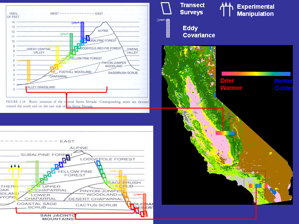
We are currently working at several field sites in Southern California and the Sierra Nevada Mountains. The Southern California sites are located at UC Natural Reserves in and around the San Jacinto Mountains (James Reserve; Boyd Deep Canyon) and also on open space that was part of the original Irvine Ranch and that is now managed by the Irvine Ranch Conservancy. The Southern California sites are the focus of work to characterize and understand the patterns of vegetation distribution, health, and land-atmosphere exchange across California. The grassland and coastal sage shrub sites in the Santa Ana foothills of Southern California include the Loma Ridge Climate Change Experiment. The Pinyon-Juniper woodland, on the dry side of the San Jacinto Mountains, is the main testbed for developing imaging tools to better measure vegetation distribution and health. The Sierra Nevada sites are part of the Southern Sierra Critical Zone Observatory.
A list of lab equipment and facilities is available here. Our research makes use of several techniques, including eddy covariance, which is a micrometeorological technique that provides direct, long-term measurements of ecosystem-atmosphere energy and CO2 exchange. Eddy flux data can be analyzed to determine the physiological responses of a site (for example, how photosynthesis increases with light), and, also, summed over a year to determine the carbon balance of a site (how much carbon it is gaining or losing). The measurements can be compared to independent techniques such as gas exchange measured with chambers and also to physiologically-based models, resulting in a better understanding of how physiology controls carbon gain, and improving predictions of how ecosystems may change in the future. We are currently operating six eddy flux sites in Southern California, and three more in the Sierra Mountains as part of the SSCZO. All of the sites are located along topographic and climate gradients; the sites range from a very hot and dry desert scrub near Palm Desert (average max T 28.8oC, average precip 129 mm) to a comparatively wet and cold montane forest in the SSCZO (average max T 14.8oC, average precip 1015 mm). A fourth site in the Sierra CZO is in subalpine forest; this site was damaged by a heavy snowpack in 2012 and will be rebuilt in fall 2014. All of the data from these sites are available at: http://www.ess.uci.edu/~california/.
