2018-Present: The Through Ice Multibeam (TIMB) system and the Grounding line Remote Operating Vehicle (GROV): Ocean robotic devices to survey ice shelf cavity and ice-chocked glacial fjords.We built and deployed a novel Autonomous Underwater Vehicle (AUV) to explore the unknown ice shelf cavities of Antarctica and Greenland and survey the pathways where warm, subsurface ocean water melts glaciers from below, de-stabilizing them, and resulting in raised global sea levels. Ice shelf cavities have almost never been explored, especially near the grounding zone (junction between ice and ocean), which fundamentally limits the ability of numerical ice sheet/ocean models to project sea level rise. Commercially-available AUVs are expensive, heavy, wide, non-modular, non-portable, with limited aperture and swath sonars, and not operable in grounding zones. We built a modular, portable, fully holonomic five degrees of freedom AUV, equipped with 360° multibeam interferometric sonar capable of 1 km swath, launchable from a 30-cm borehole in the ice, and capable of both tethered and non-tethered navigations. We deployed GROV on Petermann Ice Shelf, Greenland in May 2023 and on Zachariae Isstrom Ice Shelf in May 2024. GROV characterized ocean state (temperature, salinity), and cavity shape (top and bottom elevation and basal slopes) to provide a modicum of ground truth to evaluate ocean models and elucidate the physical processes that control ice melt. The goal is to parameterize ice shelf melt rates in grounding zones for ice sheet models to improve projections of ice sheet mass loss and in turn provide better scientific guidance to protect our shorelines. 2012-2016: Gordon and Betty Moore Foundation – Patagonia and West GreenlandThis project, funded by the Gordon and Betty Moore Foundation, deployed state-of-the-art airborne gravity, airborne ground-penetrating radar and laser profiling technologies mounted on helicopters and small fi-winged aircrafts to provide high resolution, high precision coverage of glacier thickness and coastal sea floor depth in and near the Patagonian Ice Fields of Chile and in the glacial fjords of West Greenland. Partners in the three-year project were the Centro de Estudios Cientificos in Valdivia, Chile and Sander Geophysics in Toronto, Canada. The news release on the award can be found here. |
|
2009-2019: NASA Operation IceBridge in Greenland and AntarcticaRignot served as the Science Team Lead for NASA Operation IceBridge, which has been the most ambitious airborne campaign in Antarctica and Greenland since IGY. 10 years of effort with a strong inheritance from the 1993-2008 PARCA program in Greenland and the 2002-2004 NASA/CECS campaign in West Antarctica led by Dr. Bob Thomas, former program manager of Polar Programs at NASA HQ. NASA Web site here. |
|
2011-present: ECCO3 Ocean Modeling in collaboration with JPLThe “Estimating the Circulation and Climate of the Ocean” (ECCO) project assimilates observations with models to produce sustained estimates of the complete three-dimensional global state of the ocean for studying large-scale ocean dynamics, designing observational strategies, and examining the ocean’s role in climate variability. See here |
|
2011-2013: NSF EAger proposal on the Ice Sheet System ModelISSM is the result of a collaboration between the Jet Propulsion Laboratory and University of California at Irvine. Its purpose is to tackle the challenge of modeling the evolution of the polar ice caps in Greenland and Antarctica. ISSM is funded by the NASA Cryosphere and MAP (Modeling Analysis and Prediction) programs, JPL R&TD (Research, Technology and Developmnt) and NSF. For more details, go to http://issm.jpl.nasa.gov/ NEWS: December 2011: ISSM open-source release. |
|
2007-present: NASA MEaSUREs1-2-3-4 Projects: Ice velocity, grounding line, and bed topography of AntarcticaWorking with spaceborne SAR data from various international space agencies we are producing a high-resolution digital map of ice velocity of the Antarctic ice sheet and time series of grounding line positions. Using a mass conservation approach, we also derive a new bed topography of Antarctica that is compatible with ice sheet numerical models. The products are available to the scientific community via the National Snow and Ice Data Center. MEaSUREs Antarctica. This project is funded through the National Aeronautics and Space Administration’s MEaSUREs program. Recent developments include monthly ice velocity products and yearly grounding zones. We published one reference phase map of Antarctica, with a 10-cm/yr precision in speed. |
|
2007-2014: Warm Ice Sounding Explorer (WISE)JPL in collaboration with the University of Iowa and UCI owns and operates an airborne GPR, the Warm Ice Sounding Explorer (2 MHz). |
|
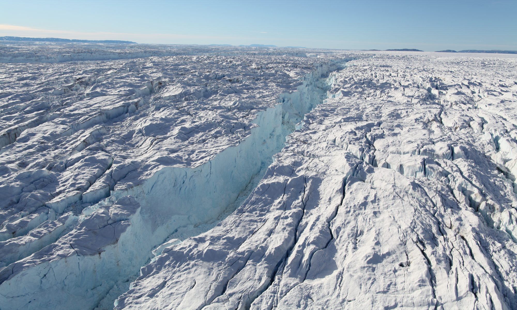
2008-present: Subaqueous melting of Greenland GlaciersWe investigate the mechanisms of subaqueous melting of glacier faces by the ocean using field surveys (multi-beam echo sounding (MBES), GROV, CTD, GPRI), remote sensing (InSAR, Landsat, S2, World View DEM and Ortho rectified imagery, TanDEM-X DEMs), and modeling (ISSM, MITgcm). Each year (2008-2024), we embark on a field expedition in Greenland to investigate a new area, map entire fjords system, including the submerged face of calving glaciers. We started with West Greenland in 2008, extended our survey with MBES in 2010 in West Greenland, Southeast Greenland, Northwest Greenland, and leaped onto NASA’s Earth Venture Suborbital mission “Ocean Melting Greenland” (OMG) in 2015-2019. In 2023, we collected GROV data on Petermann. In 2024, we surveyed the ice shelf in front of Zachariae Isstrom, northeast Greenland. All the data are shared publicaly (omg.jpl.nasa.gov) and are part of the International Bathymetry Chart of the Arctic Ocean (IBCAO). |
|
2007-2012: Stability of Larsen C Ice Shelf in a Warming ClimateThis project started under the hospice of IPY is ongoing to unravel the secret of why ice shelves start to break up. No, hydrofracture is not the answer; no storms and tsunamis are not the answer. |
|